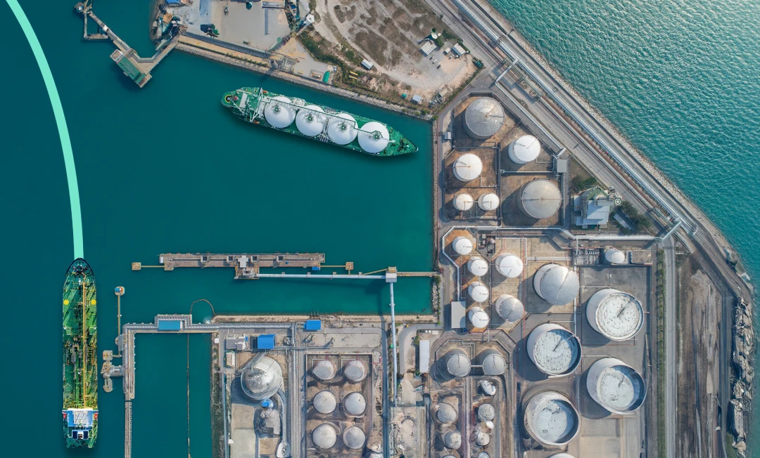
Privateer Elements fuses satellite and sensor data to uncover operational signals across the production lifecycle for oil, gas, and renewable energy. From upstream production sites and midstream pipelines to offshore tankers and global refining networks, our real-world insights drive your rapid response and long-term resilience.
Combine satellite imagery, radio signals, AIS, and other sensor data to monitor oilfield activity, infrastructure construction/maintenance, and midstream disruptions from sea to space.
Leverage AI-powered pattern recognition to detect unusual activity such as unplanned shutdowns, environmental incidents, and maintenance issues that could affect operational reliability, safety, and financial performance in energy assets.
Follow vessel movements, pipeline-adjacent activity, and storage utilization to build a comprehensive view of how energy products move and where delays may emerge.
Trace every data output to its source, giving analysts confidence in what they’re seeing and executives the context they need to act.
Automate workflows, set alerts for operational anomalies, and integrate insights directly into your platforms without the need for additional tooling or overhead.
Use a single interface to support upstream, midstream, and downstream workflows, eliminating the need for fragmented geospatial tools across your organization.
Track vessel activity near critical subsea infrastructure using AIS and Earth Observation data. Detect unauthorized anchoring, fishing, or loitering in exclusion zones to prevent accidental damage, reduce unplanned downtime, and improve threat response times.
Monitor tanker movements and loading/unloading activity at key crude storage hubs and export terminals. Anticipate inventory swings and detect shifts in global supply dynamics before official data is released.
Track operational signals, such as flaring, thermal emissions, and vehicle traffic, at refineries worldwide. Identify outages, maintenance activity, or capacity ramp-ups to forecast downstream supply impacts.
Analyze drilling intensity, rig movements, and well pad development in major oil basins. Use these insights to assess production outlooks, contractor utilization, and investment trends across upstream operations.
Detect surface anomalies or oil spills near offshore platforms and coastal facilities. Enable faster incident response and regulatory reporting to mitigate environmental and reputational risks.
Monitor pipeline corridors for third-party encroachment, land movement, or vegetation overgrowth. Prevent damage, reduce outage risk, and ensure regulatory compliance for midstream operations.
Rapidly assess flood, wind, or fire damage across refineries, offshore platforms, and pipeline infrastructure post-disaster. Prioritize response, estimate downtime, and coordinate insurance or recovery plans to minimize disruptions and reduce environmental risk exposure.
Monitor construction activity at renewable energy sites, such as wind farms, solar arrays, and biofuel plants. Use change detection and site activity analysis to assess project progress, forecast capacity additions, and track investment trends in low-carbon alternatives.
Monitor compressor stations, pipelines, and storage facilities across remote or distributed gas networks. Detect corrosion, ground disturbance, or environmental threats to reduce maintenance costs, prevent service disruptions, and ensure compliance with safety regulations.
Assess vessel activity, flaring patterns, and loading operations at LNG terminals. Gain early indicators of demand shifts and export volumes to inform trading strategies and market outlooks.
Detect and quantify gas flaring events at production sites. Track emission patterns over time to support ESG compliance, investor reporting, and policy risk exposure.
Track pad buildouts and fracking activity via change detection. Monitor water usage near sensitive areas or drought zones to assess environmental impact and support regulatory readiness.
Identify methane emissions across well pads, pipelines, and compressor stations using satellite-based spectral analysis. Identify super-emitters, monitor leak trends over time, and prioritize inspections to reduce environmental impact, regulatory risk, and operational cost.
Monitor pipeline corridors for third-party encroachment, land movement, or vegetation overgrowth. Prevent damage, reduce outage risk, and ensure regulatory compliance for midstream operations.
Rapidly assess flood, wind, or fire damage across compressor stations, LNG terminals, and storage facilities post-disaster. Prioritize response, estimate downtime, and coordinate insurance or recovery plans to maintain network stability and reduce operational and safety risks.
Track biogas and hydrogen production facilities using satellite-based indicators like construction progress, flaring, and transport activity. Monitor the growth of clean fuel infrastructure to assess capacity expansion and market maturity in the evolving energy mix.
From off-the-shelf products to custom solutions, Privateer Elements is the one-stop shop for Energy leaders to power their operations with advanced insights.
No PhD required.
See how Privateer enables the energy sector to detect risk, monitor infrastructure, and optimize operations using real-world geospatial intelligence.
Get In touch