Elements integrates all-domain awareness with decision-ready analytics. Transform raw data into decisions that matter across land, sea, air, and space.

Fast-track implementation with one of our pre-built solutions, or build a custom capability across domains to meet your specific organizational needs.
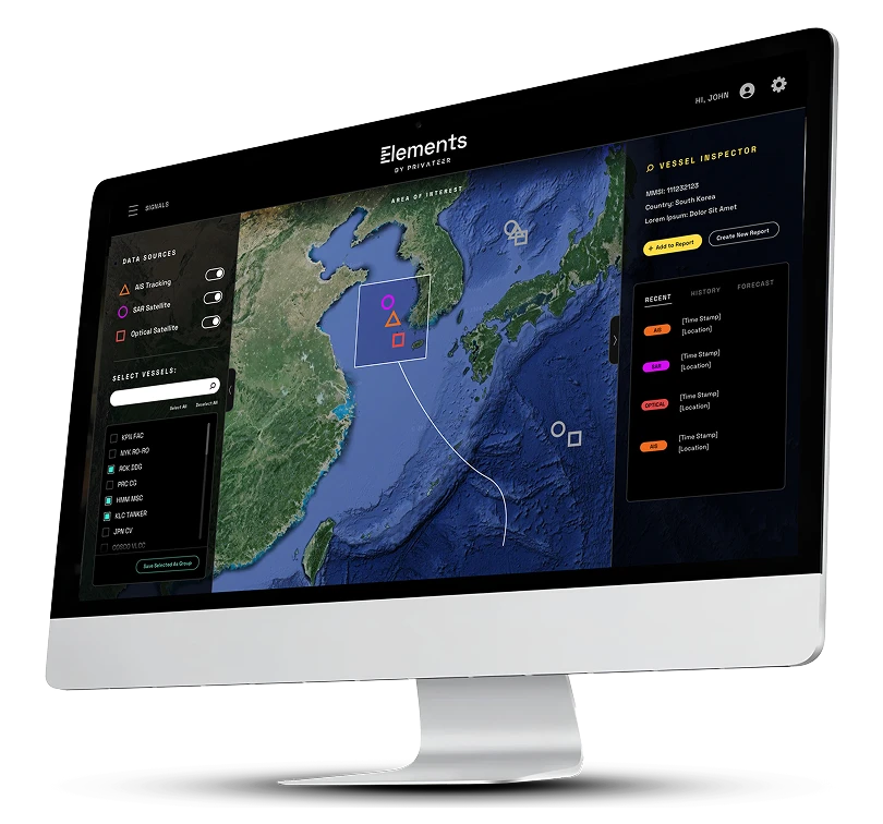
Elements: Sea transforms raw data—AIS, RF, satellite imagery, sub-sea sensor data, and more—into insights that provide strategic advantage at sea. Detect vessel movements, illicit behavior, and potential risks across coastal zones and deepwater infrastructure.
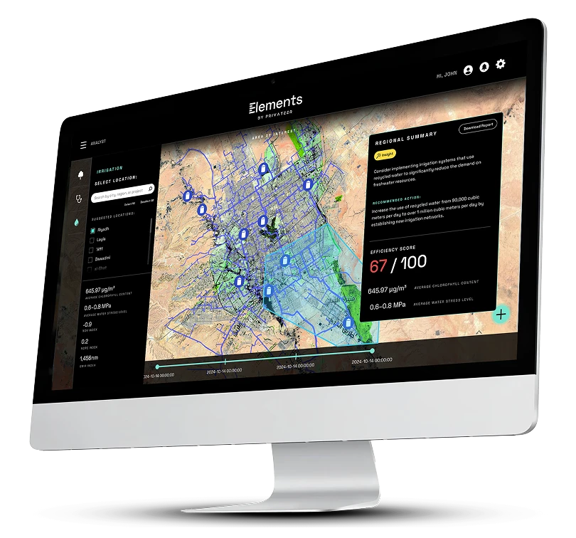
Elements: Land fuses satellite imagery, geospatial data, and AI-powered analytics to track changes on the ground and reveal patterns across wide areas. From land use change detection to infrastructure monitoring, Privateer brings clarity to complex ground-level activity.

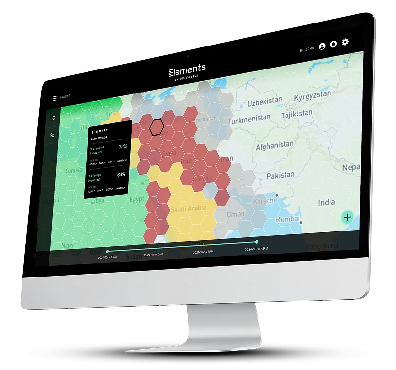
Elements: Air integrates signal detection and satellite positioning capabilities to track aircraft, drones, and other moving airborne assets with precision. Understand traffic flows, monitor sensitive airspace, and flag suspicious behavior.

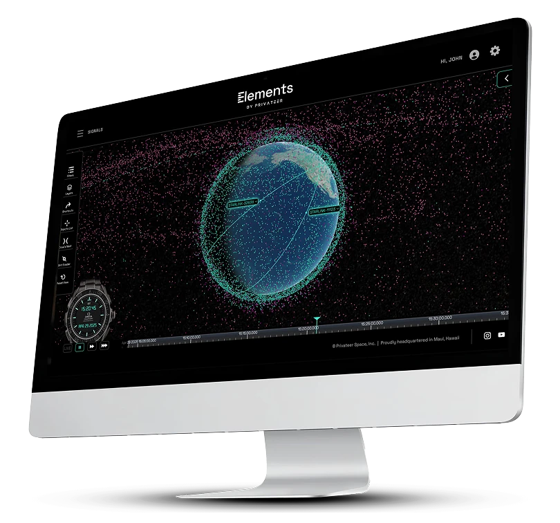
Elements: Space brings structure to the complex and fast-changing space environment. It tracks, catalogs, and analyzes objects in orbit, helping governments, agencies, and researchers stay ahead of potential risks or disruptions.

From off-the-shelf products to customized deployments, Elements gives teams a single platform to power operations with advanced insights–no dedicated geospatial team required.


Explore detailed information on capabilities, use cases, and FAQs in our downloadable guide.
Download Pdf
See how Privateer turns complex geospatial data into clear, actionable insight for government decision-makers at every level.
Get In touch