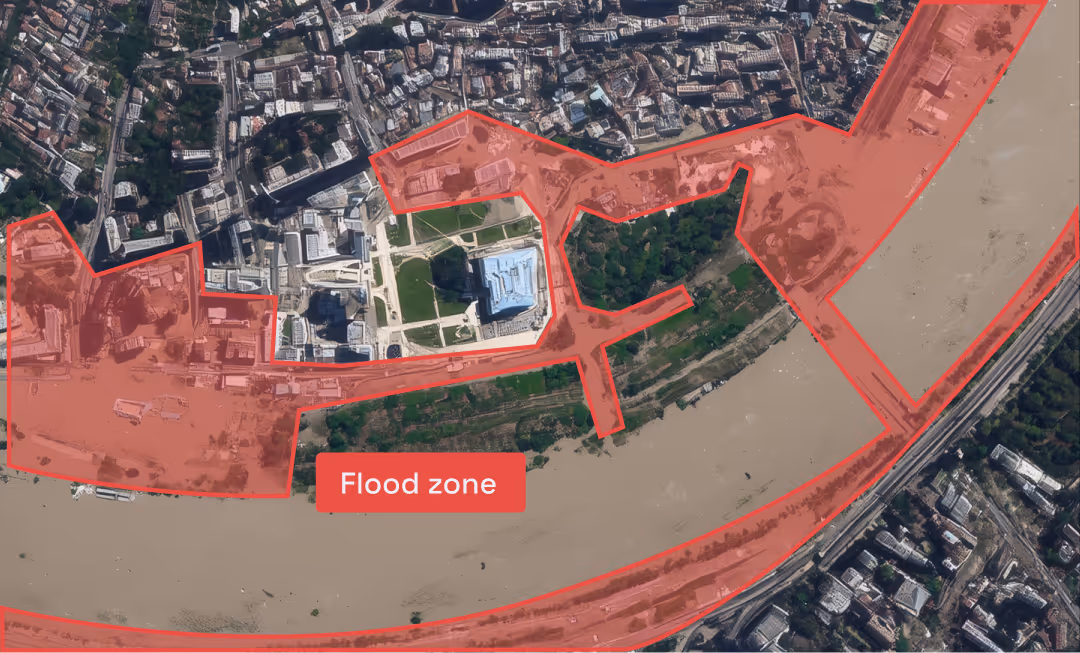
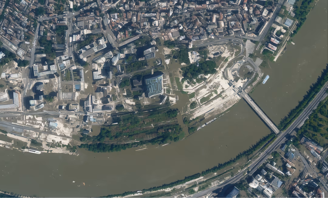
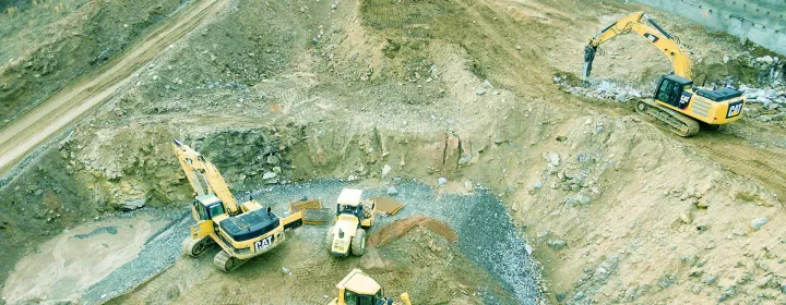
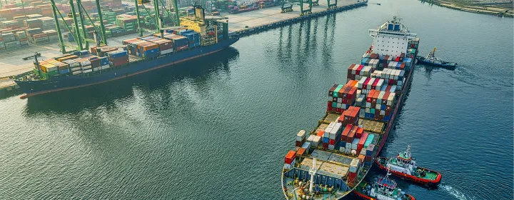
From port traffic analysis to construction site monitoring to real estate portfolio validation, Privateer Elements leverages the power of satellite imagery to surface real-time signals that give finance and insurance teams a new alternative data edge in decision-making.
Combine satellite imagery with diverse data sets to provide key insights from land to sea to space to provide a detailed view of asset activity and economic signals.
Filter, contextualize, and translate data into decisions, not dashboards. Nothing to configure, request, or decode.
Our insights are built on transparent, traceable data that analysts can interrogate, explore, and validate to support deeper decision-making.
Leverage AI-powered pattern recognition to detect unusual activity, such as unexpected shutdowns, environmental changes, and stalled infrastructure projects, that could impact financial performance or insured risk.
Streamline high-frequency analysis, reduce manual effort, and accelerate time to insight by automating the detection of key events.
Access insights through API or web-based tools from a single geospatial intelligence platform designed to support multiple use cases across your organization and eliminating the need for fragmented solutions.
Remotely inspect properties to assess key features like roof type, building materials, number of stories, and proximity to natural hazards or emergency services. Gain deeper risk insights, reduce dependence on manual inspections, and price premiums with greater confidence and efficiency.
Monitor vessel activity, routes, and port behavior to assess risk exposure across hull, cargo, and liability coverage. Detect loitering patterns, high-risk transits, or deviations from planned routes to reduce fraud, improve underwriting accuracy, and price policies with greater precision.
Quickly assess damage to insured assets following hurricanes, floods, or wildfires using high-resolution imagery and automated change detection, driving faster loss estimation and claim processing.
Track construction progress, verify milestones, and detect delays or inactivity at insured sites. Reduce site visits, flag potential project risks early, and improve coverage accuracy for construction-related policies.
Use NDVI and other spectral indices to monitor crop health, detect drought or pest stress, and validate planting/harvest activity. Support parametric insurance models, streamline claims verification, and reduce loss adjustment costs.
Monitor insured industrial sites for environmental compliance. Detect illegal dumping, encroachment into protected areas, or unreported land use changes to better manage liability and enforce underwriting conditions.
Analyze vegetation density, historical burn areas, and proximity to ignition sources to refine wildfire risk scores. Improve risk selection, adjust pricing in high-risk zones, and advise policyholders on mitigation steps.
Track activity on surrounding sites to benchmark progress, understand supply dynamics, and identify saturation risks in fast-developing areas.
Track real-time progress of residential, commercial, or infrastructure projects using high-resolution imagery and change detection. Independently verify developer reports and spot delays early.
Monitor city growth, zoning changes, and surrounding land use to assess long-term potential of planned developments. Identify early signals of gentrification, new transport links, or commercial buildouts.
Evaluate proximity of developments to flood plains, fire-prone zones, or seismic faults. Support risk-adjusted valuations and future-proof investment theses.
Track vessel queues, berthing patterns, and container yard activity at major ports. Anticipate shipping delays, assess trade bottlenecks, and gain early signals of commodity flow disruptions.
Monitor operational intensity at refineries, mines, and manufacturing hubs through thermal signatures, material stockpiles, and traffic patterns. Use these signals to anticipate supply fluctuations, outages, or increased capacity.
Use satellite-derived vegetation indices (e.g., NDVI) to monitor crop development, detect stress, and estimate yield across major growing regions. Inform soft commodity positioning and identify risks to supply ahead of market consensus.
Detect events such as flooding near mines or wildfires near transport routes. React faster to risk events that may impact commodity production, pricing, or logistics.
Monitor crude storage levels at key terminals, and track oil tanker locations, speeds, and loitering behavior to anticipate shifts in global oil supply and demand dynamics.
From off-the-shelf products to custom solutions, Privateer Elements is the one-stop shop for Finance & Insurance leaders to power their operations with advanced insights.
No PhD required.
See how Privateer can help you unlock the power of geospatial data to drive your investment and insurance strategies.
Get In touch